Rides bikes, paddles sea kayaks, takes pictures. Life on the road & my home in Cornwall.
The Wild West
Posted on
Bolivian bikepacking - cross-country, via network of dirt roads and remote trails, from La-Paz to the Sajama volcano (6,542m / 21,463 ft) in the west of the country.
Happily the winds were not as bad as forecast and I only needed four (and a bit) days to cover the 260ish km to Sajama. It could have been five days but for the asphalt stretch between La Paz and Coro Coro; I was able to get 100km under my wheels on the first day. Also helpful was the ‘new to me’ network of telefericos / cable cars in La Paz. Getting out of La Paz on a bicycle used to involve a steep climb with gradients in excess of 30%, or a ride up the toll motorway, but for an additional fare bikes can go on the cable cars. A few hard minutes of carrying a bicycle, loaded for five days on the road, up the staircases to the embarkation platform being a more than fair swap for a long slog up the canyon side to El Alto.
In the two and a half days between Calacoto and Sajama I met just two people on the road. One was an old woman walking with two cows and a dog, who asked where I was going, and just chuckled with the words “muy lejos” (very far) when I said I was headed to Sajama….
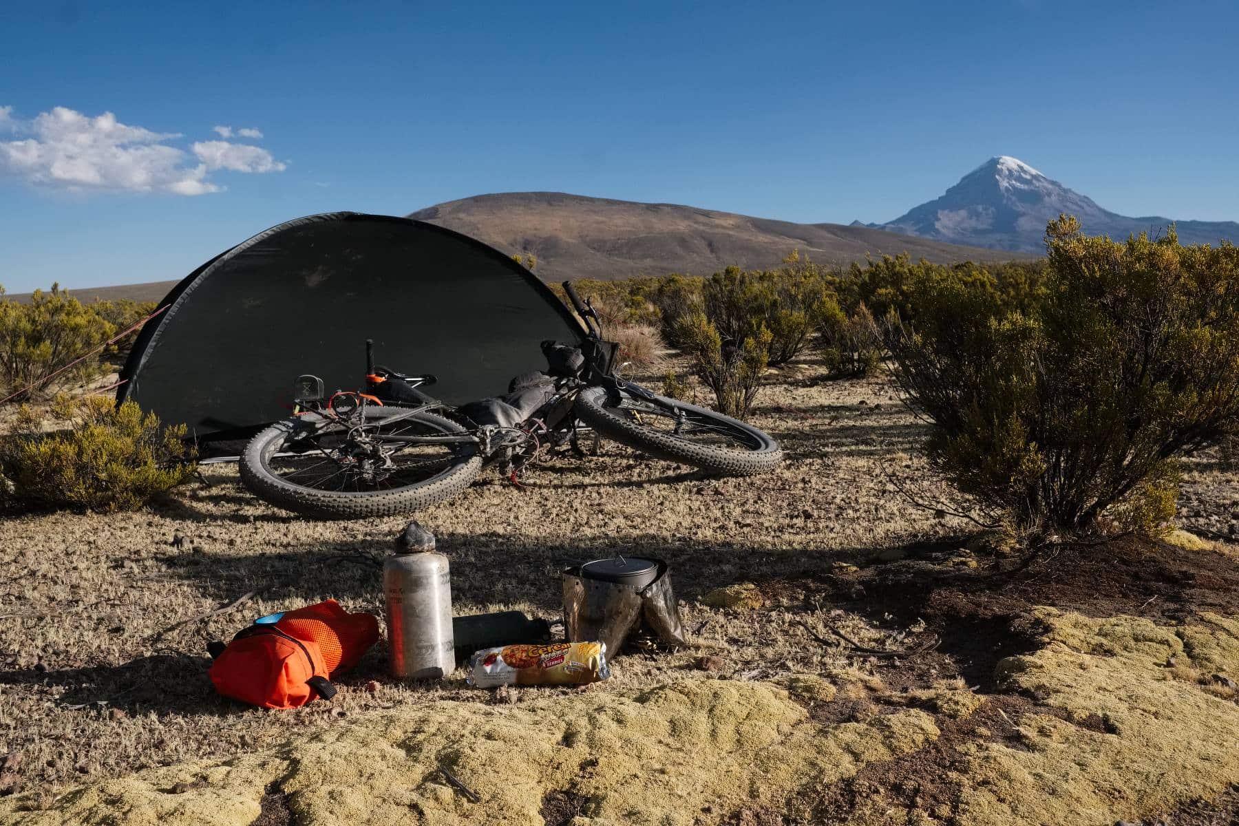
It was a good ride. I’m resting up in Sajama pueblo as write, feeling really very run down from the altitude and poor altiplano food. Quite chesty today too so before I set sail for Chile in the morning a day of intensive rest is in order; I live in some fear of the return of bronchitis while all the way up here in the cold, thin air. Yesterday I rode out to some hot springs for a soak in the shadow of one of the surrounding volcanoes, but today I think I might not even do that, instead an opportunity to sling up the story of the last few days on the road. As usual I’ll use pictures rather than an excess of words. There are quite a few so apologies if this post is a little slow to load. Apologies also for any typos, it’s cold here this morning and my fingers are numb….
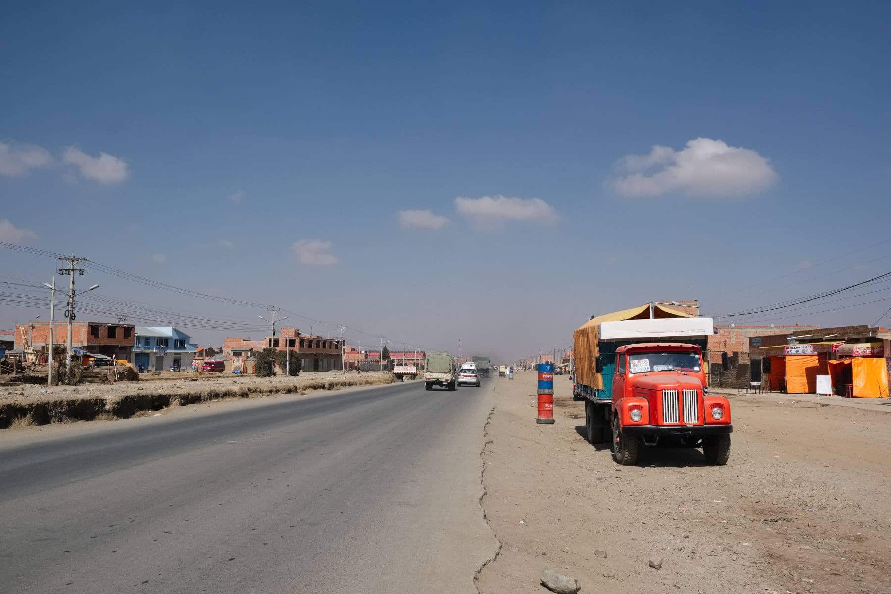
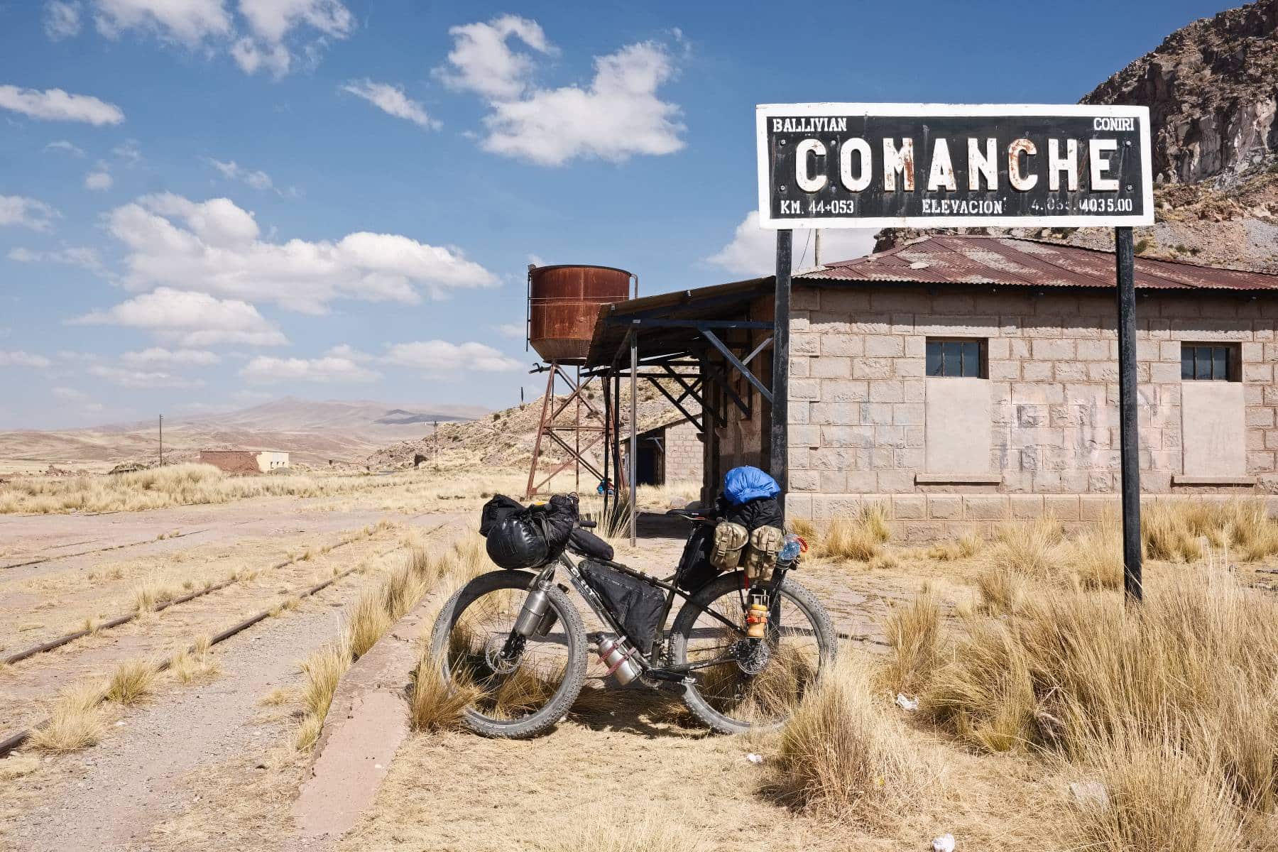
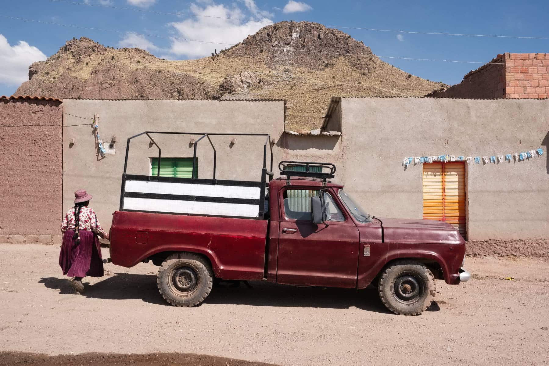
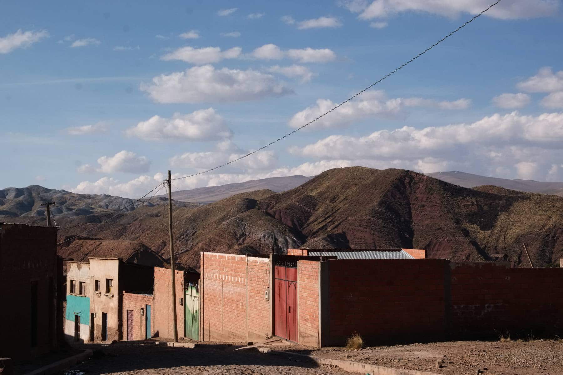
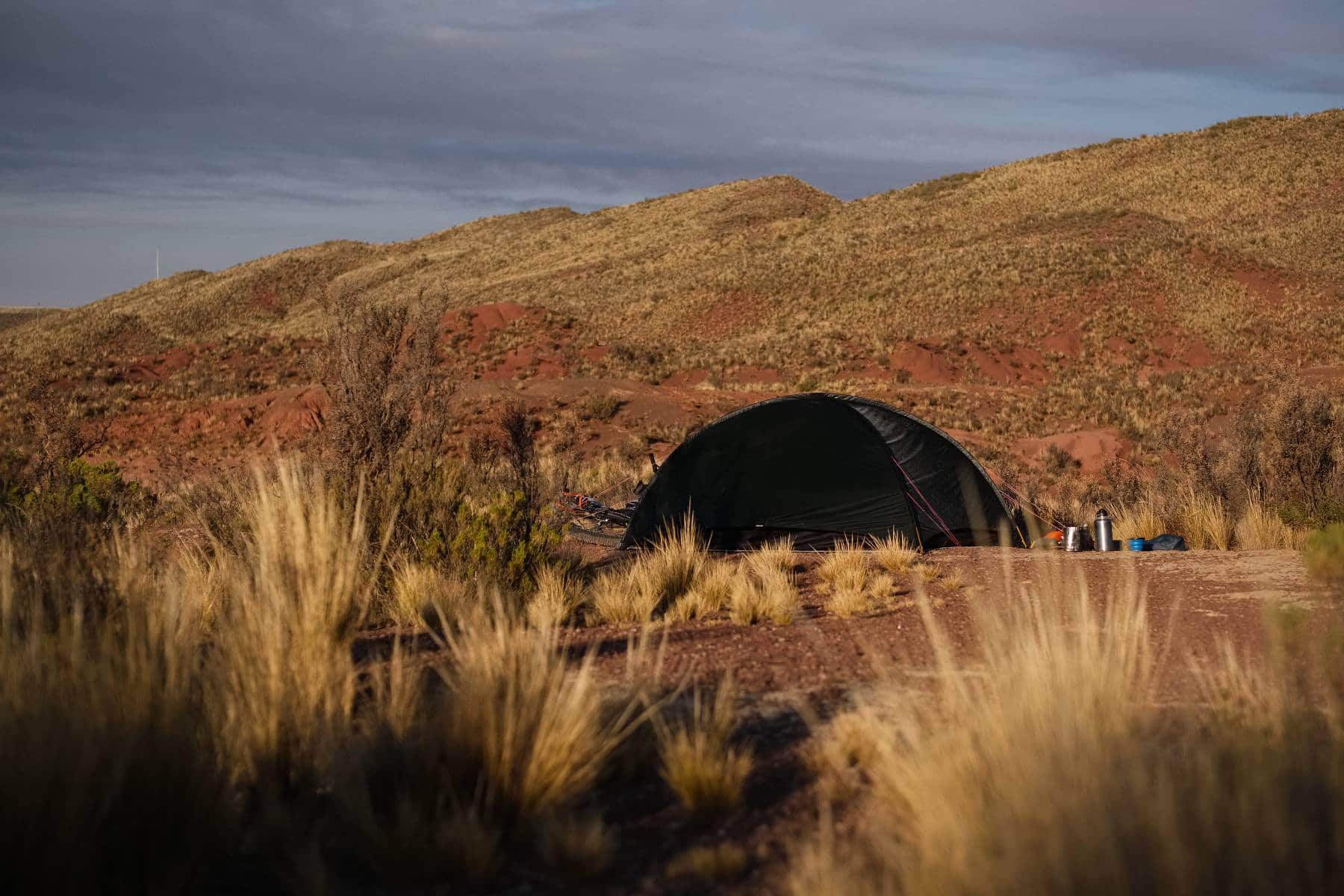
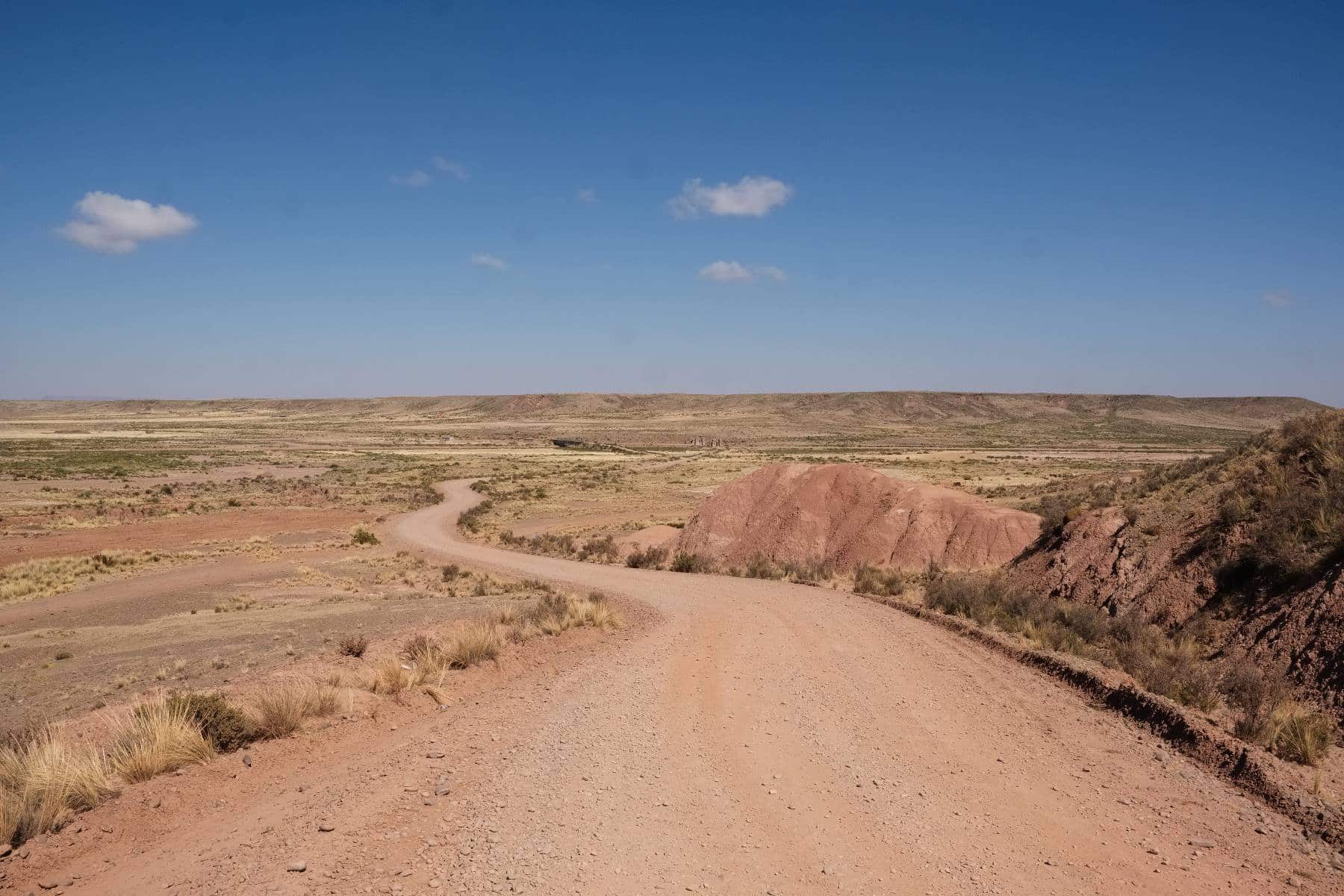
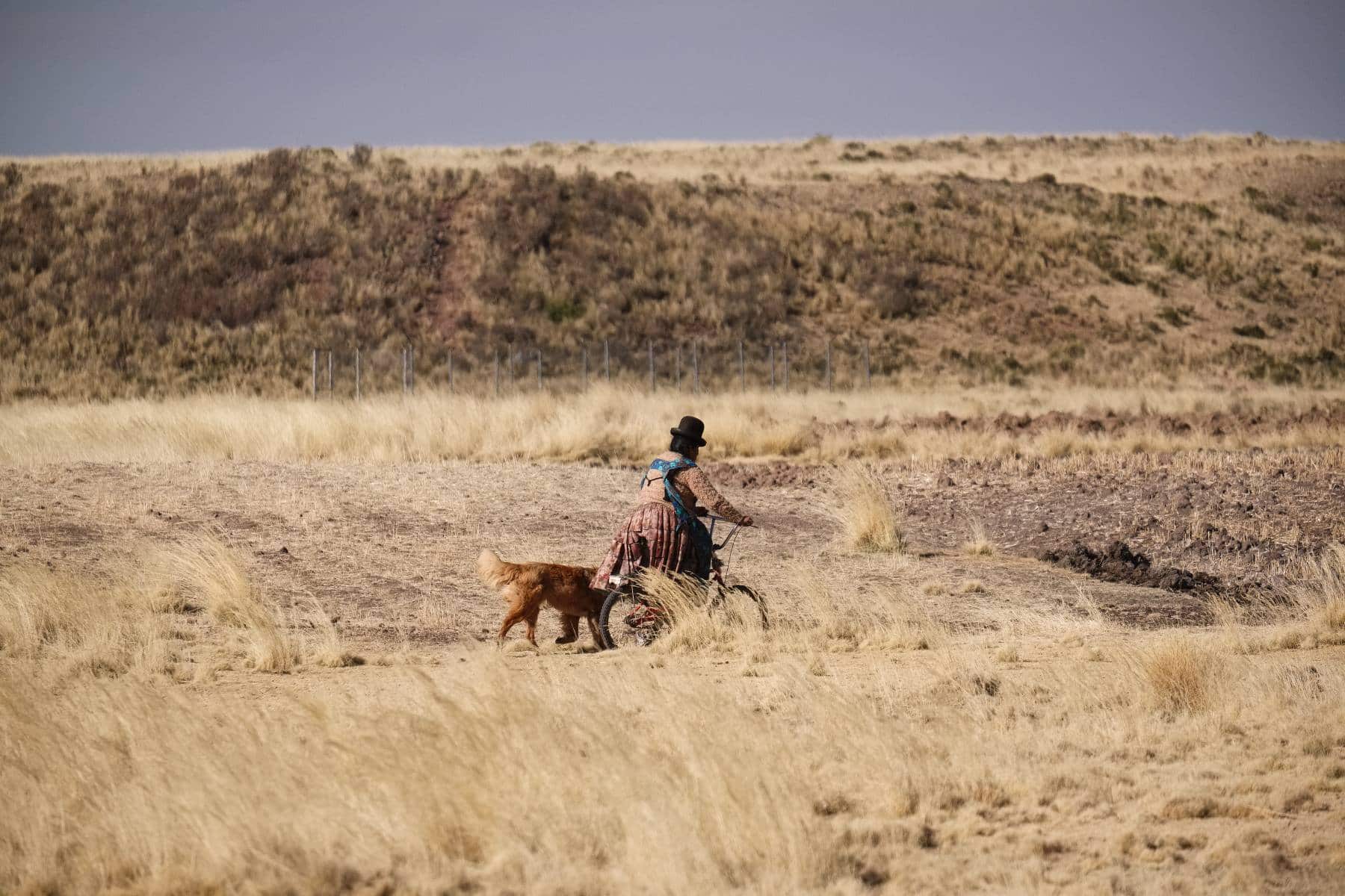
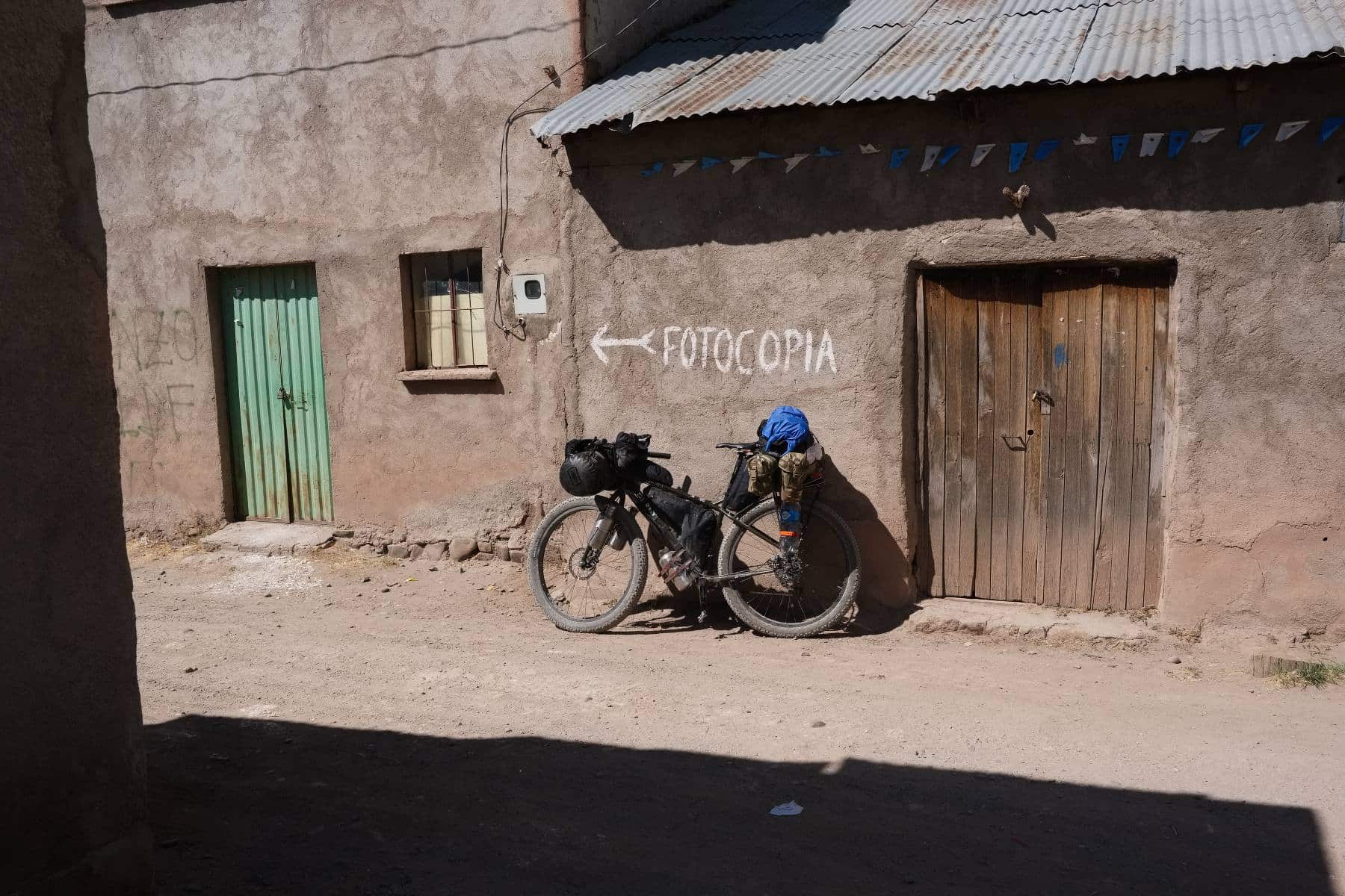
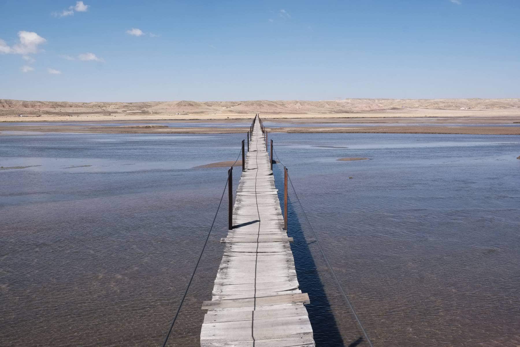
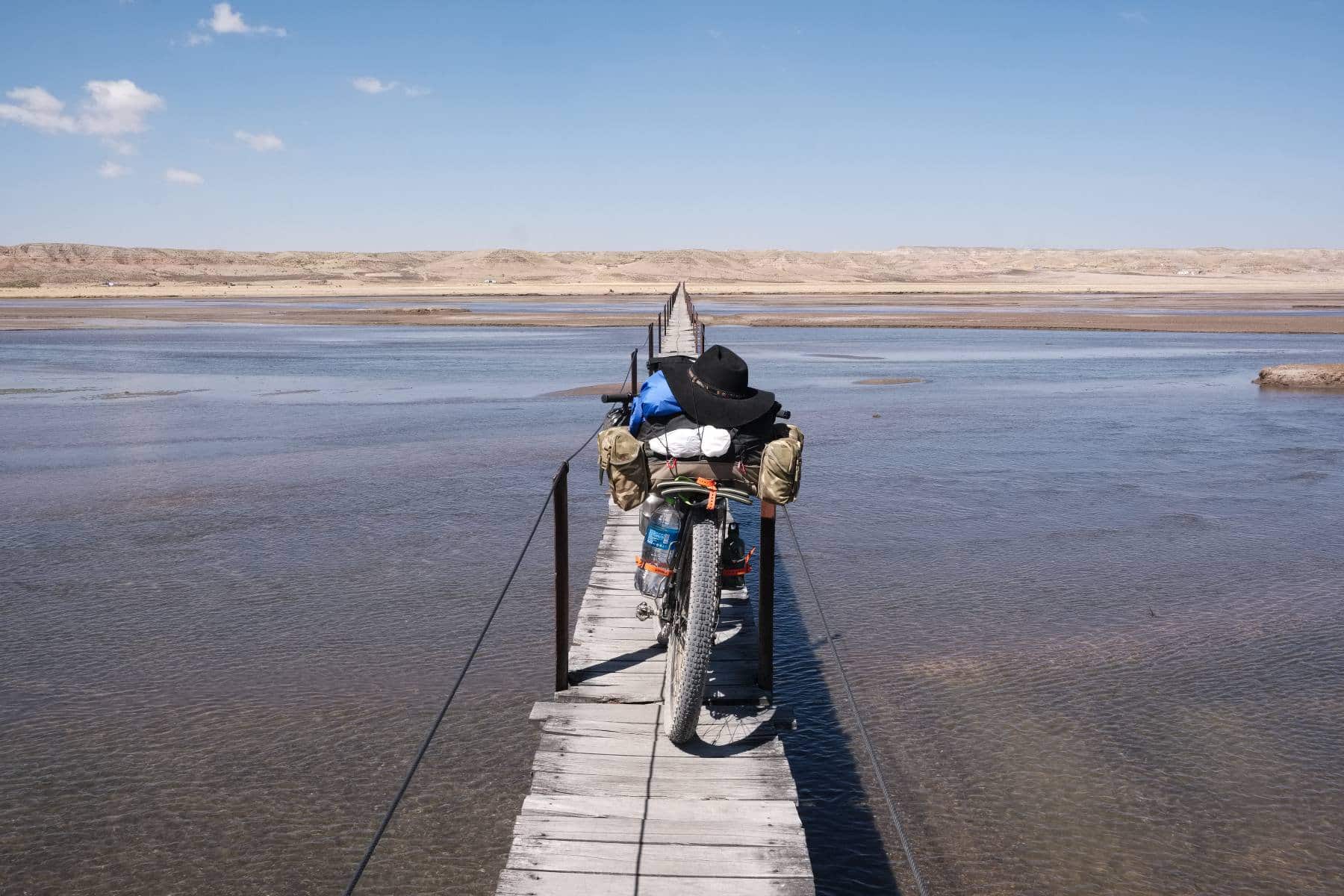
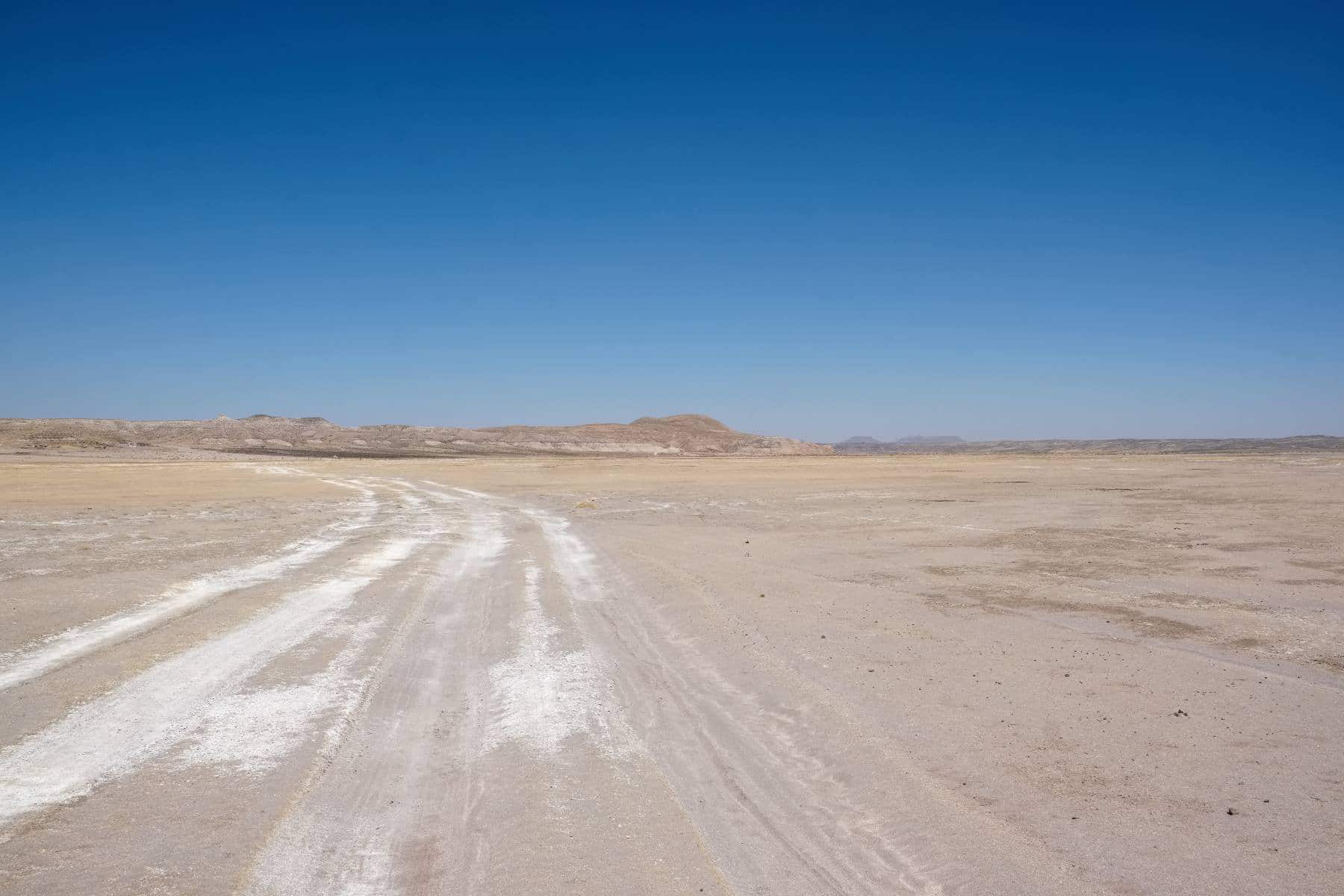
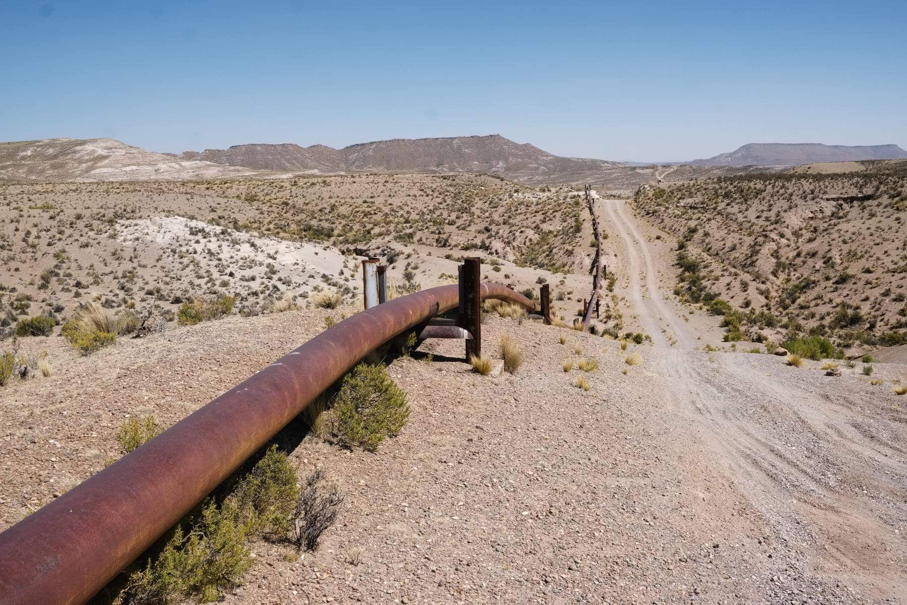
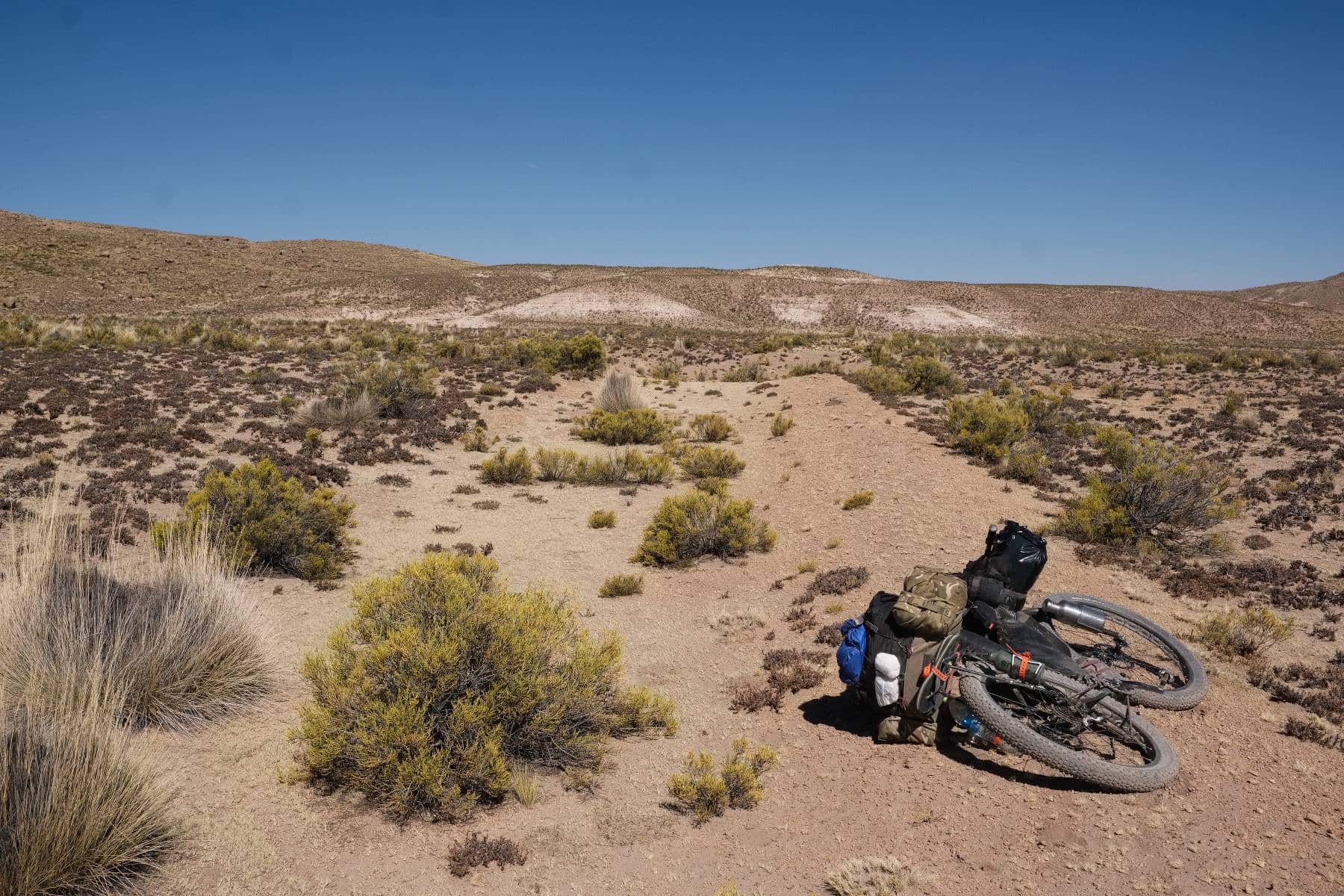
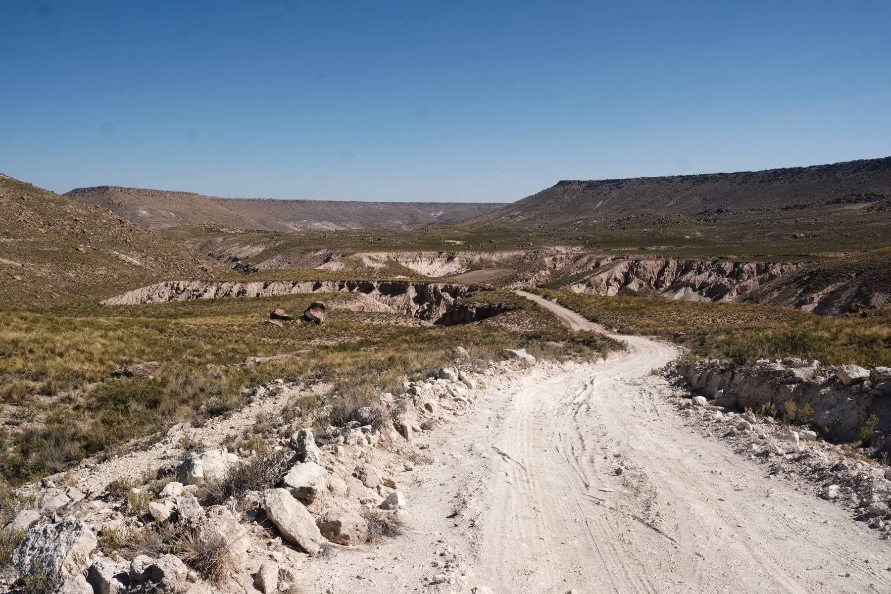
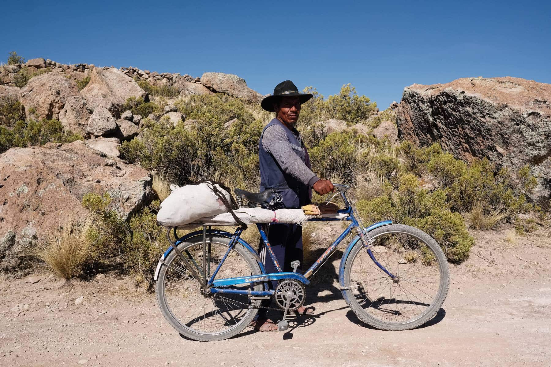
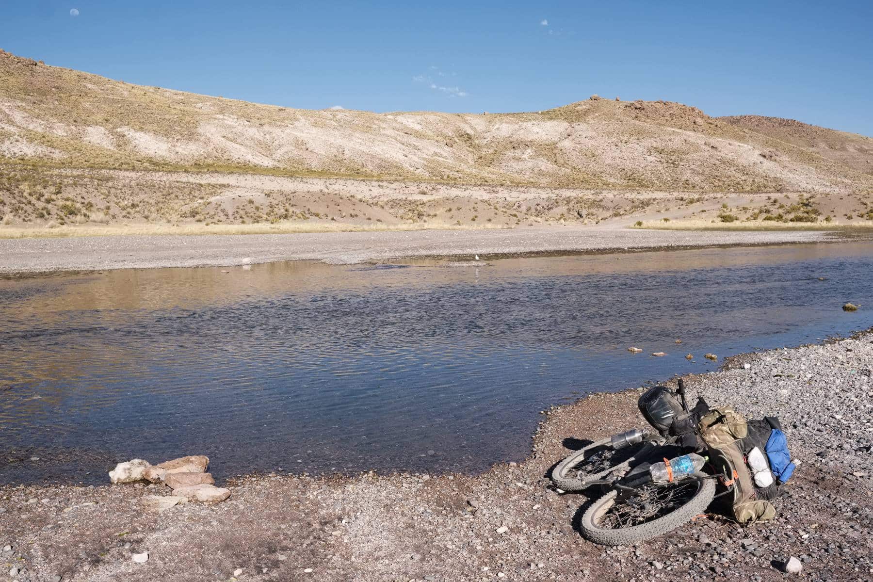
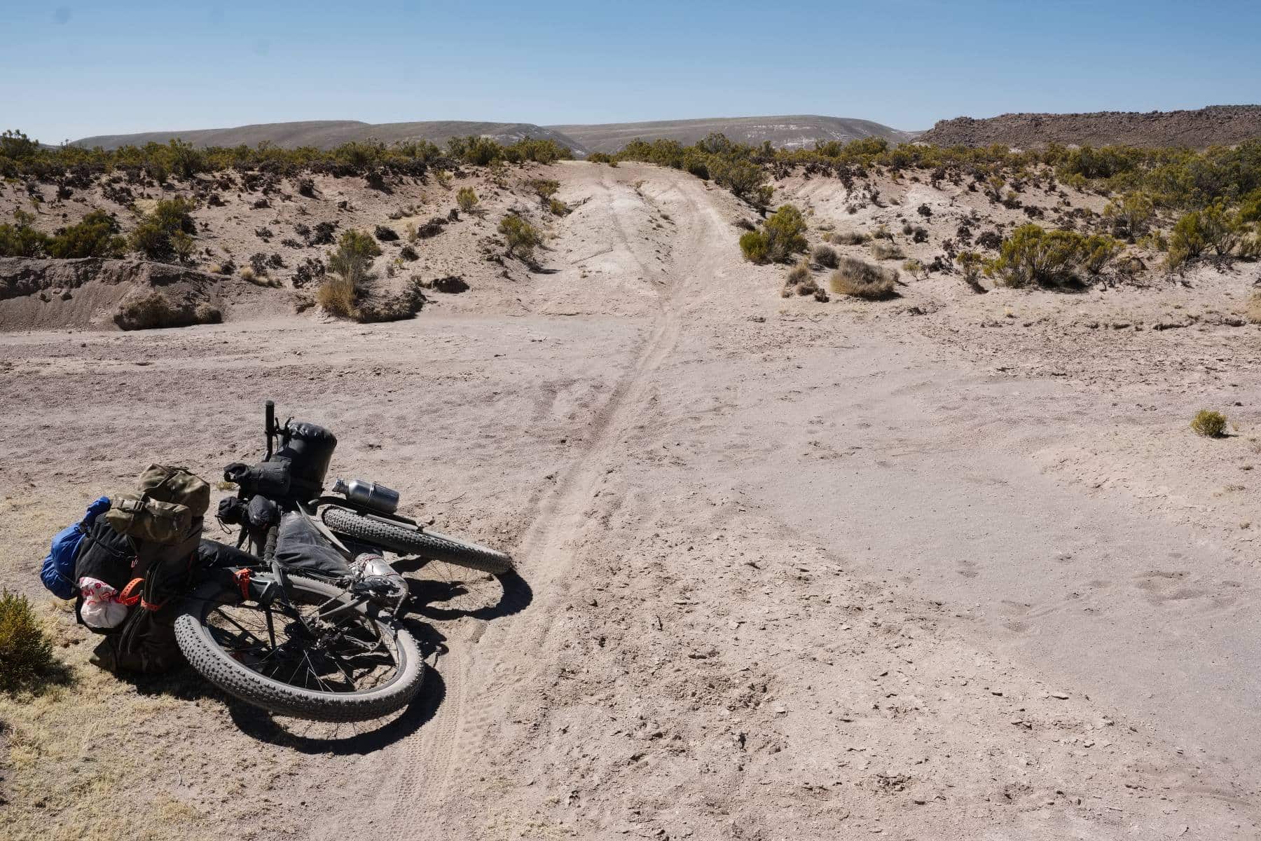
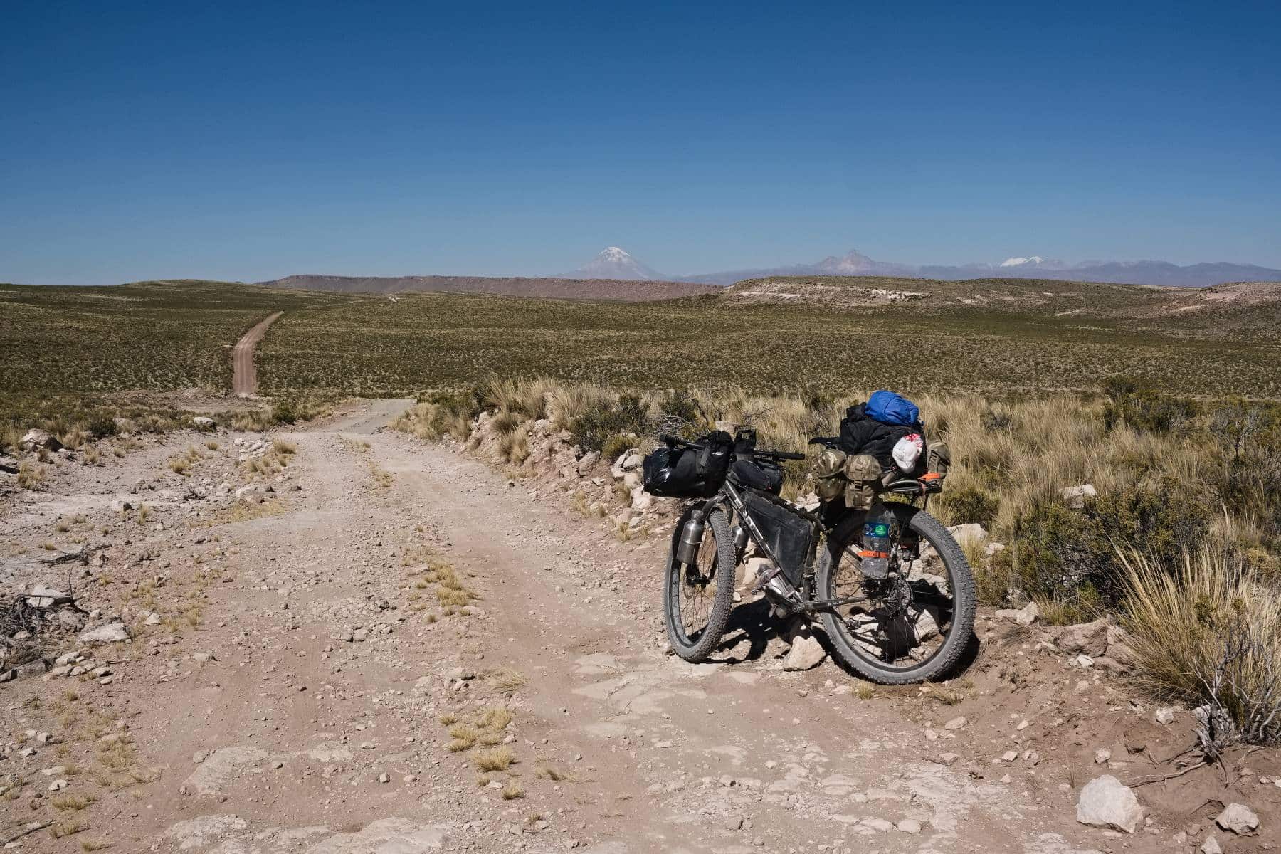
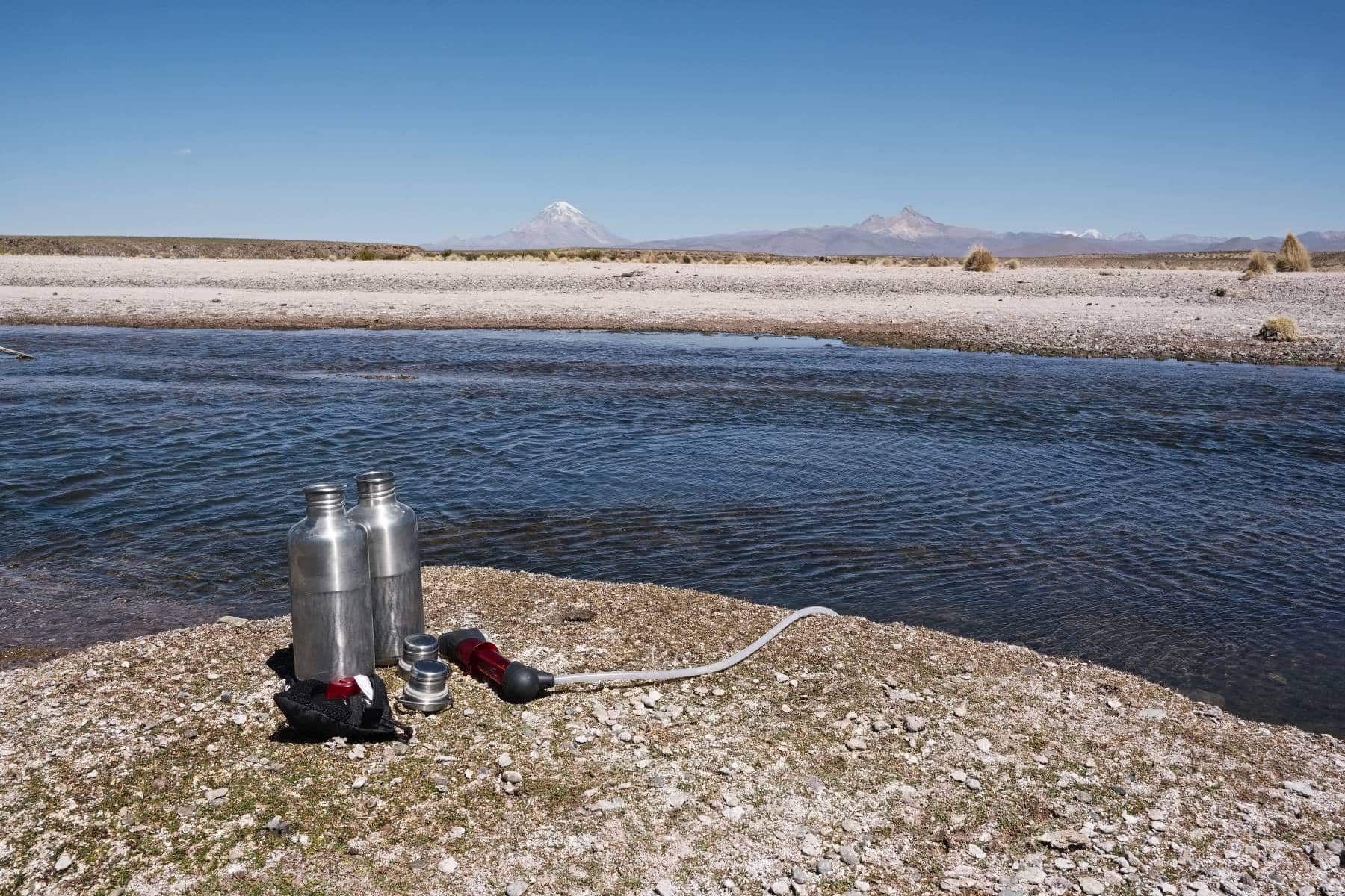
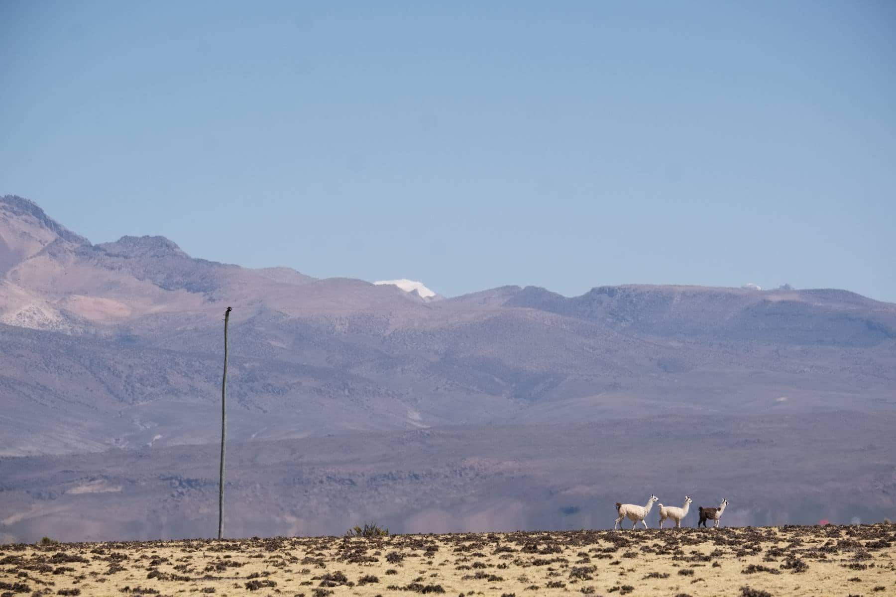
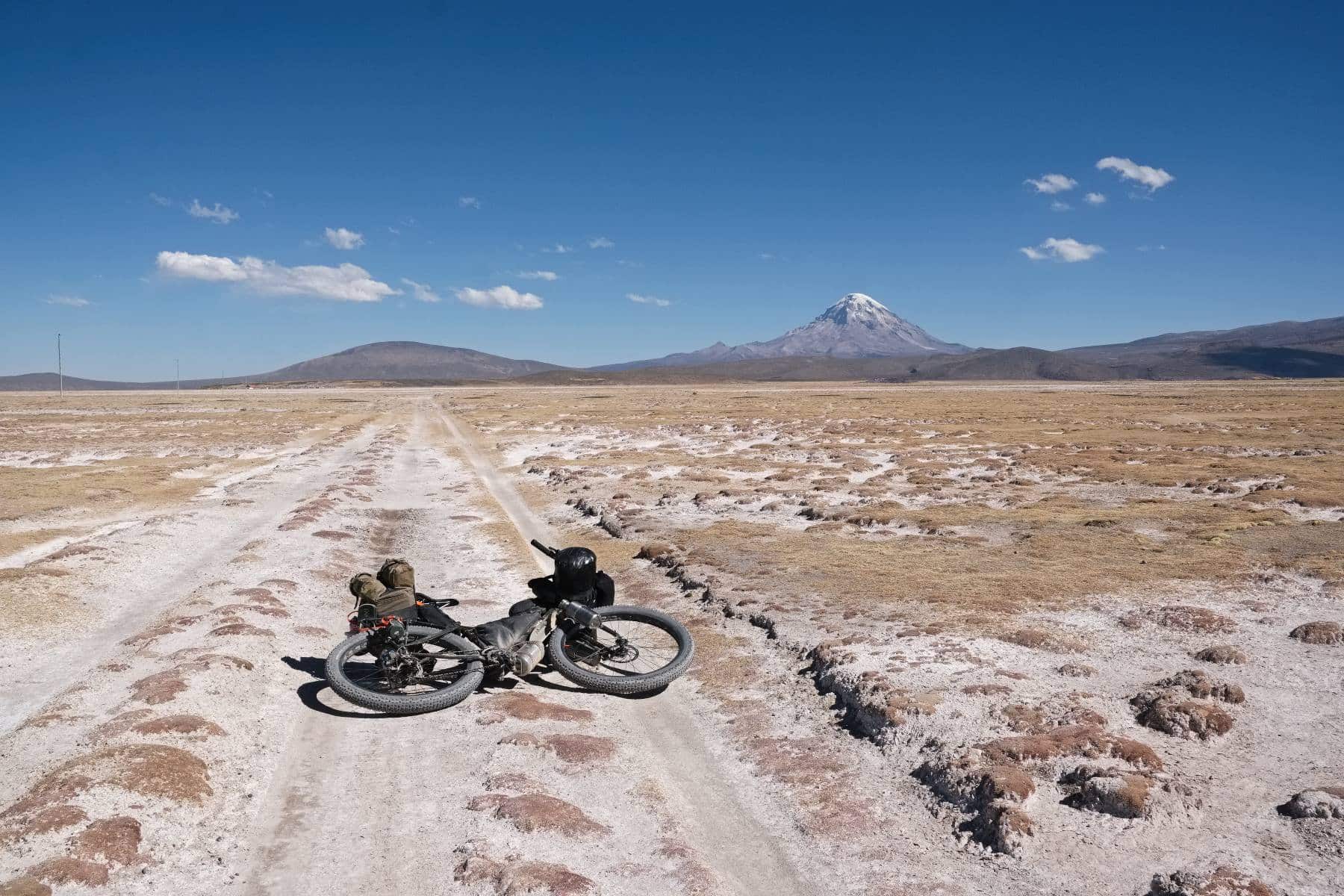
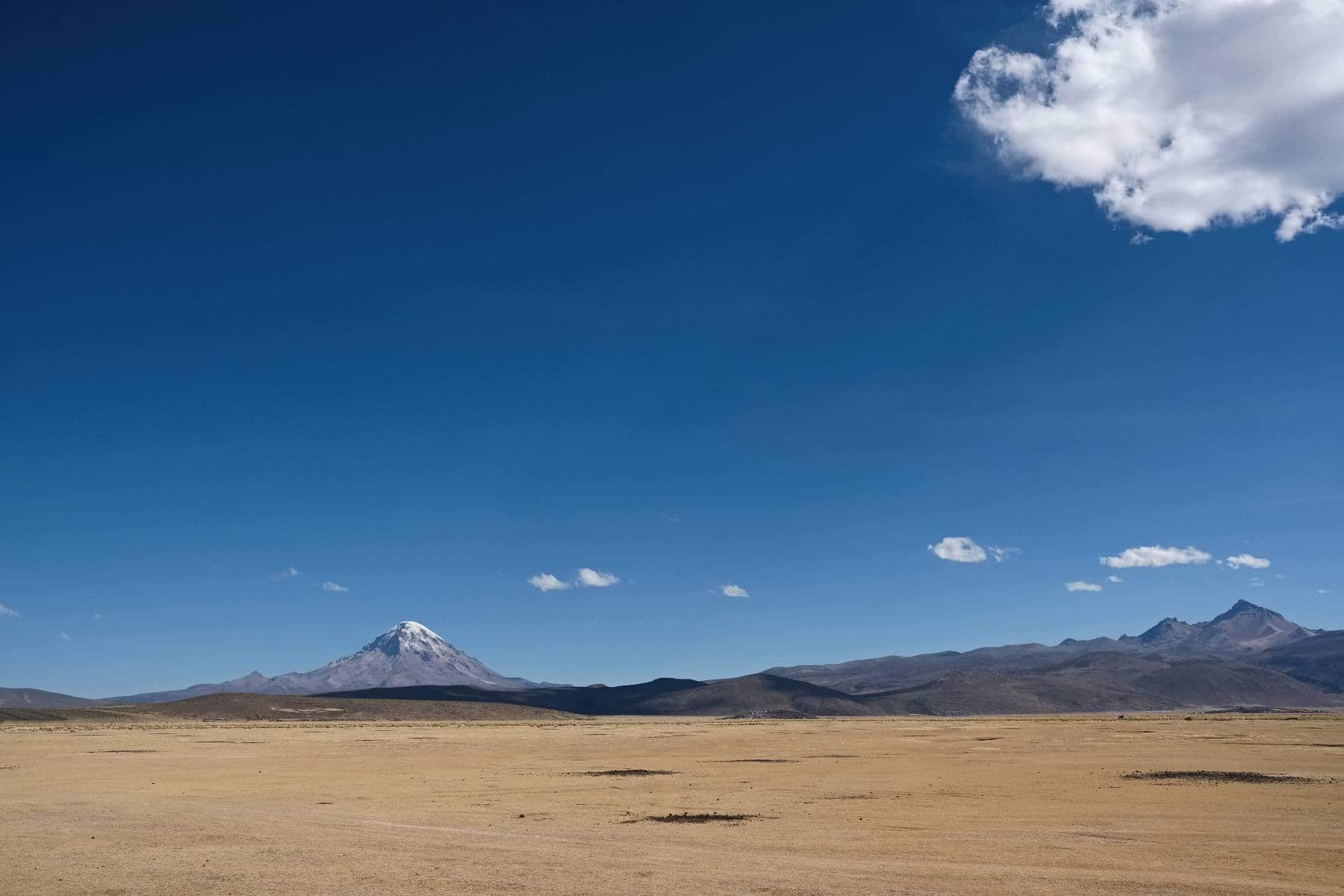
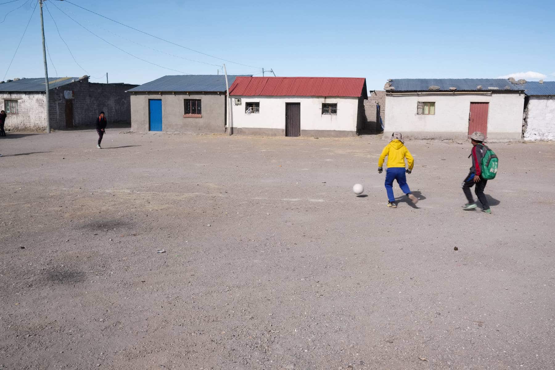
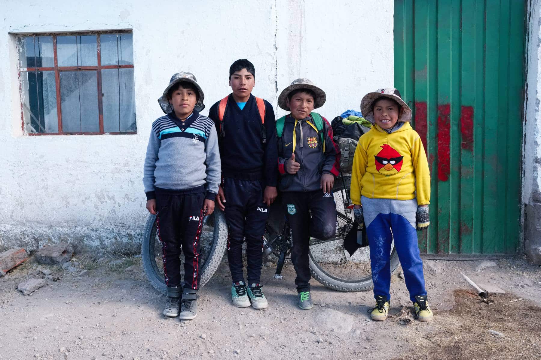
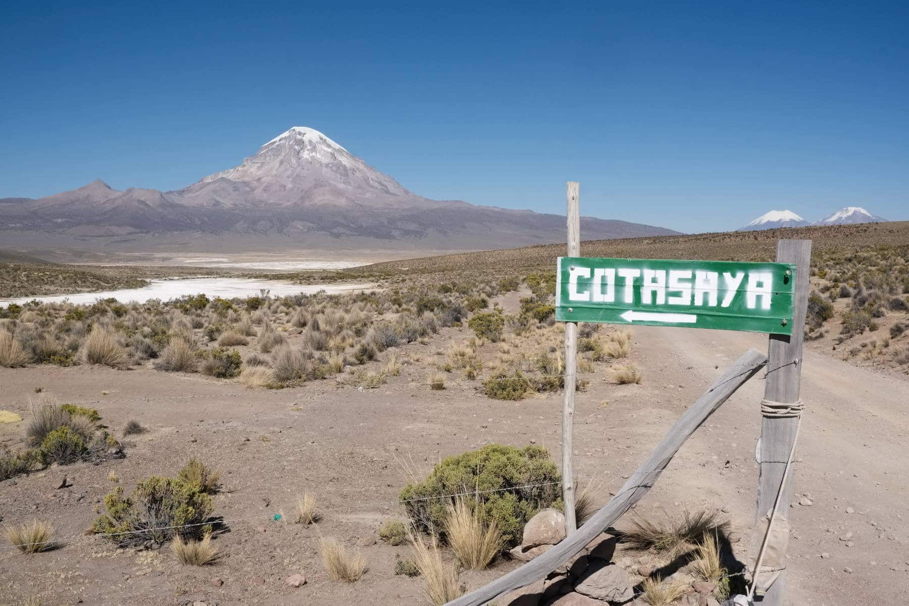
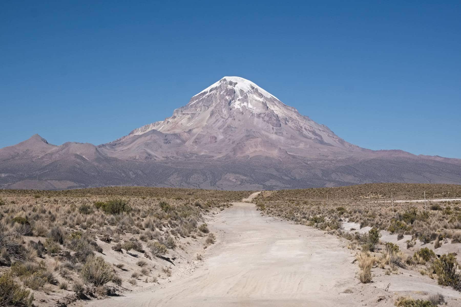
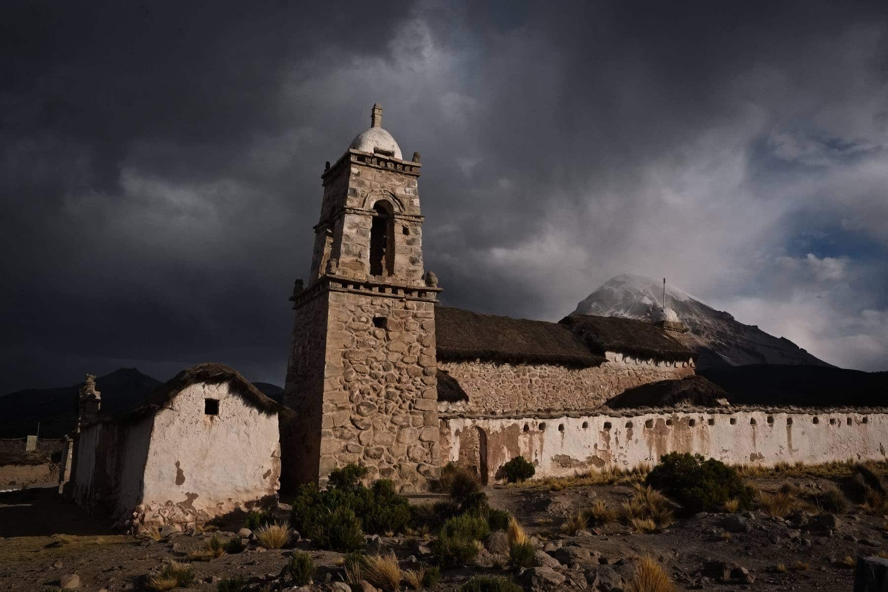
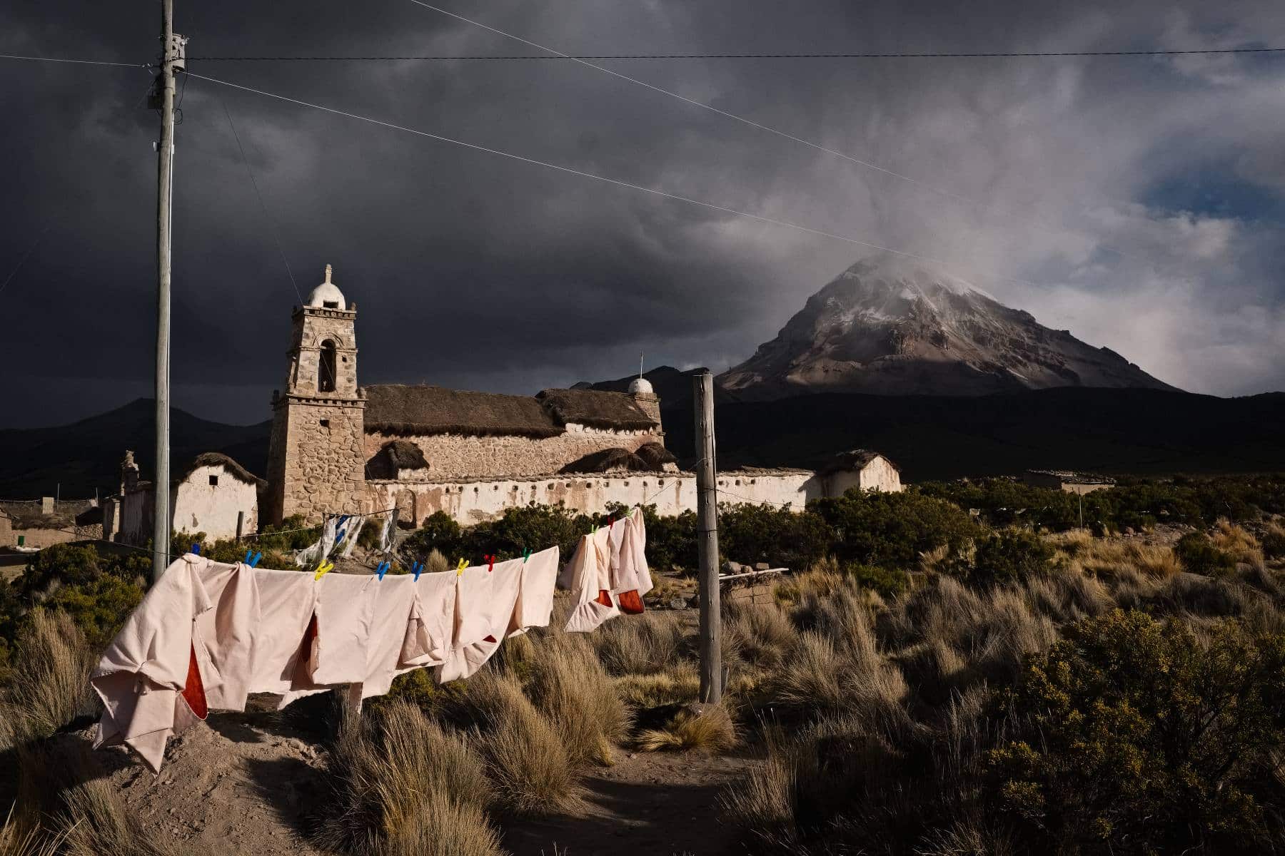
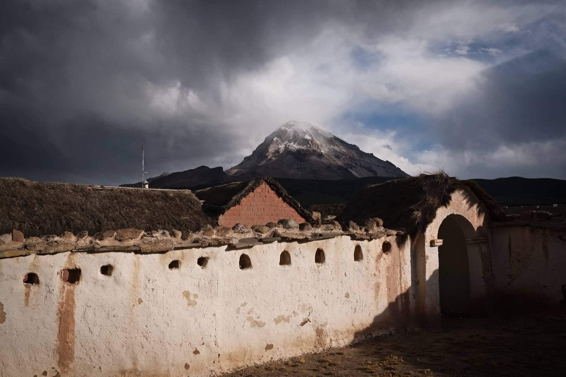
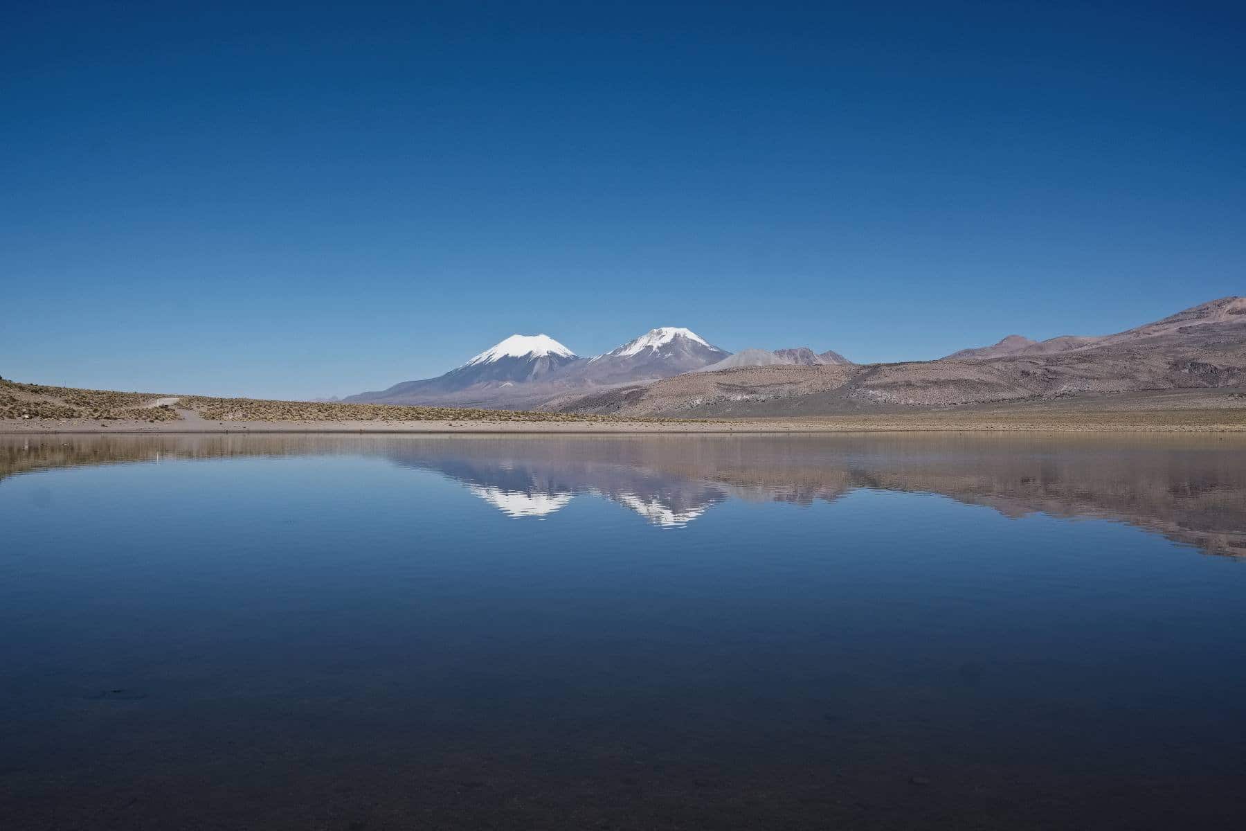
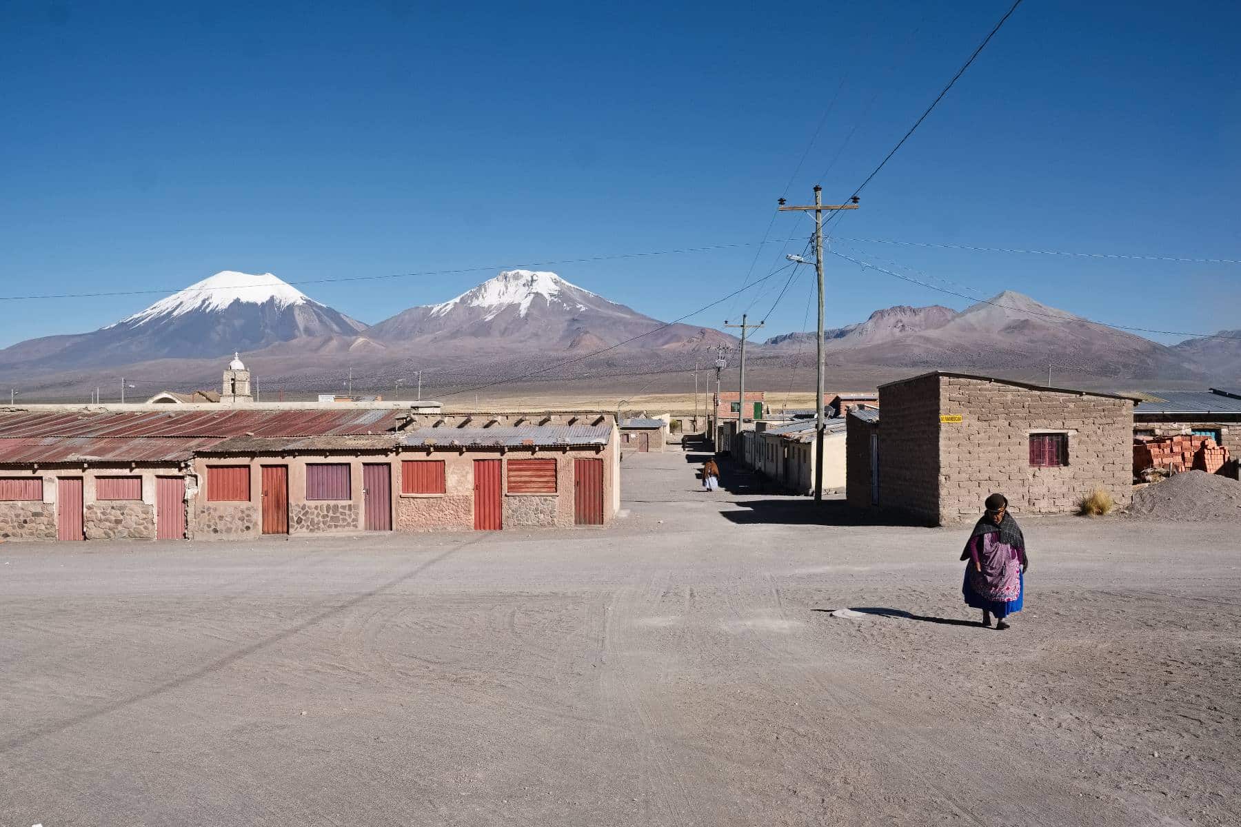
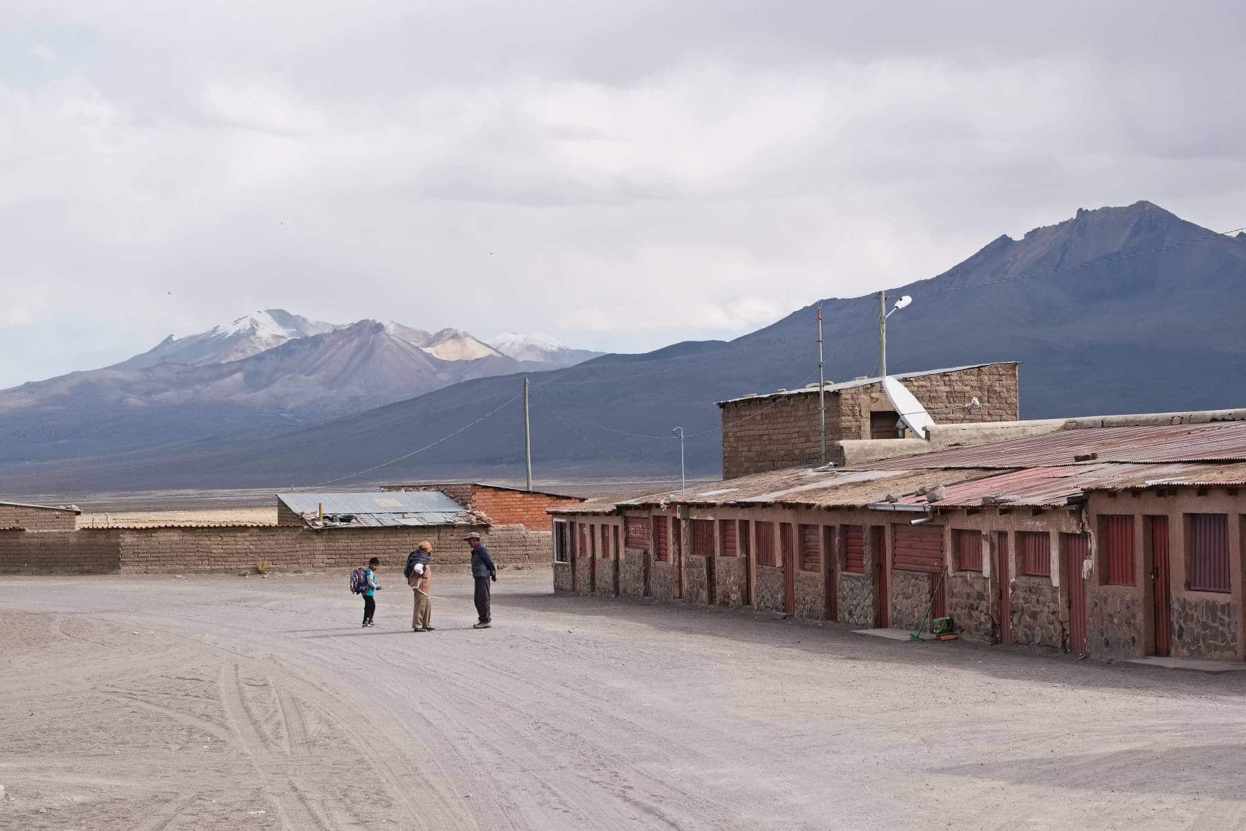
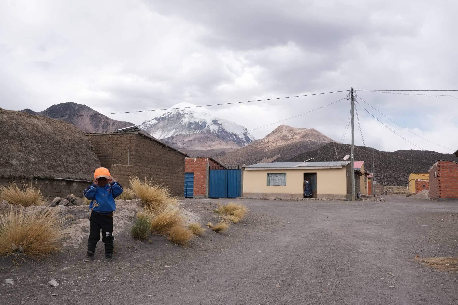
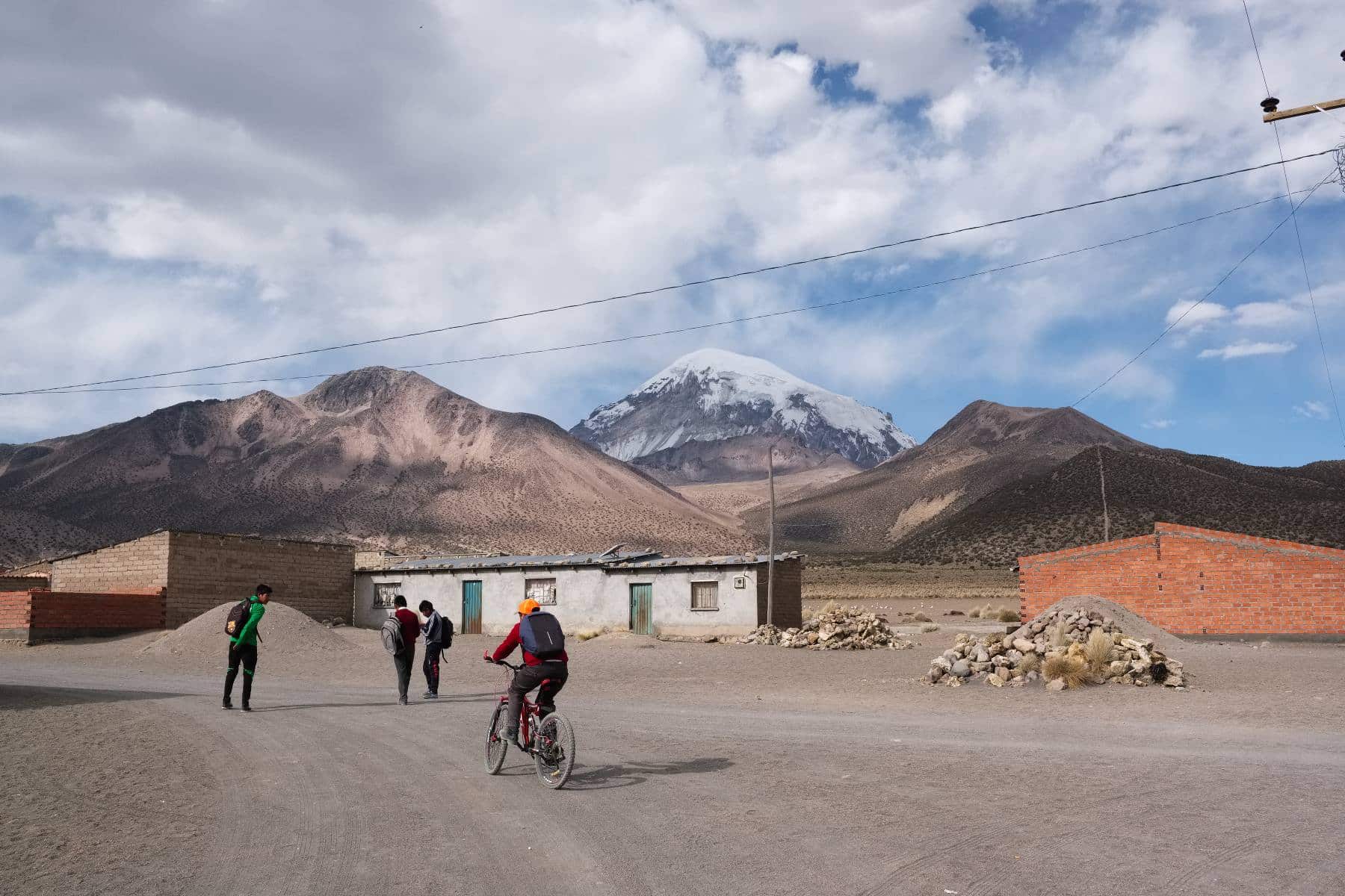
Leaving El Alto. El Alto is the sprawling altiplano city that surrounds the canyon of La Paz. It is Bolivia’s fastest growing urban centre, and in my direction of travel the sprawl reaches all the way to the town of Viacha 25km away. The traffic is heavy in spots but so slow moving it’s not really a problem.. aside from the fumes. The dogs were bas**rds…Cue the Ennio Morricone soundtrack.. Once clear of the urban sprawl it is very much the wild west. I love the feel of these outback towns, particularly when there is a railroad to ride along and discover the rusting infrastructure of Bolivia’s steam locomotive days. Back in 2010 I spent 2 days riding along the railroad from Tupiza because the road had been washed away by storms, that was interesting riding through tunnels wondering if a train was going to come. One did but at 11pm at night while in my tent wedged onto a patch of grass next to the line. Left the line after two days and followed a compass bearing straight across the altiplano, no trails, to rejoin civilisation at Atocha via the riverbed.Comanche sits on the altiplano about 70km southwest of La Paz. Although asphalt it was a good ride to get here; no traffic, scenic, and I’d stumbled across a college (La Paz) bicycle race outside of Viacha. Stopped for a natter with the marshals at the turn before moving on.The asphalt ended at the small mining town of Coro Coro.I found a dusty spot to put my tent on what looked like an old, eroded mudslide. Seemingly the only flat spot for miles…Southwest of Coro Coro there is an awful lot of nothing. The track varied from soft sand to horrible 6-inch corrugations. I felt happy to be able to come back here on 3″ wide rubber rather than the 2″ rubber that was considered the gold standard for rough-stuff touring when last in Bolivia.Cool suspension bridge enroute to Calacoto.. foot, horse, and bicycle traffic only. I like bridges…Motor vehicle traffic is virtually non-existent out here, instead bicycles are an important means of getting around. I enjoyed the sight of this cholita pedalling her way across the pampa with dog in tow.Calacoto. The last place of any consequence before reaching Sajama 3 days later. Featuring one basic shop in the plaza, I have no idea what population size.. not much, perhaps 80-100.CalacotoFrom Calacoto this crazy footbridge across a wide river.Many of the timbers were broken, rotten, or just missing. Probably wouldn’t want to ride across with combined weight of bike + rider in the middle… Not as white knuckle as the “Kibber cable car” but still an interesting experience.Bleak. Not knowing what was ahead I left Calacoto with six litres of water on board. Waterways and so on were on the map but this late in the dry season they can be little more than stagnant, saline pools.. if there’s any water at all. In the event I need not have worried. Four litres would have been enough.I joined this oil pipeline for a few km. It runs from near Cochabamba in the east to the coast of Chile at Arica.The track here was very soft…… and then it disappeared altogether. Tracks and trails across the altiplano are often wiped out during the wet season, and are remade, or not, through usage once things dry up again.Some really fine riding. In the two and a half days between Calacoto and Sajama I met just two people on the road… one was an old woman walking with two cows and a dog, who asked where I was going, and just chuckled with the words “muy lejos” (very far) when I said I was headed to Sajama…... and the other was this chap. I was sitting by the side of the track emptying sand out of my boots, having just pushed up a dry river bed, when he appeared. He’d ridden a six hour round trip to the nearest village and was on his way home. We sat and shared a packet of biscuits from my stash before setting off together for the next few km until the track forked, he went right, I went left. He didn’t have more than a very few words of Spanish but was able to tell me all the Aymara names for the surrounding mountains, and point out the best fishing spots in the river we arrived at. I did ask his name but he reeled off a string of names so quickly I completely lost it. Super chap and great company for a couple of hours.I would have liked a picture of the two of us riding along, near identical hats cocked at a jaunty angle to shield from the low, late afternoon sun.Boots and socks off. It was too deep and too soft to ride. good, clear water though so as the evening was approaching I camped nearby.The view from the tent. Another bloody freezing night.More sand and emptiness….. before, at last, a glimpse of the distant Sajama volcano on the horizon.A few tiny communities dot the altiplano. They are deserted during the day as folk are out with their herds of alpaca and llamas. It would be possible to beg water ‘in extremis’ if necessary but I’m reluctant to do so as many of them exist under extremely ‘dry’ conditions as it is.I stumbled across a deserted work camp with some plastic chairs scattered outside. It was lunchtime so I took advantage… one tired, grubby cyclist.Water stop…Locals…Boots off again…. On reflection I could have ridden straight through but the water was mucky and looked quite deep with a very soft bottom. My boots are goretex lined which is great but had I put a foot down and filled them up they could take days to dry and I’d end up with trench foot or something.. not to mention that they would freeze solid overnight, and forming ice crystals are extremely destructive.Saline flats approaching the village of Pichaca.Fine views of Nevado Sajama. It is an extinct stratovolcano with a summit at 6,542m / 21,463 ft.Pichaca sits at about 4100m / 13,500ft. There is a communal tap for drinking water in the plaza, I needed a refill.There is also a very basic shop. My arrival caused some excitement in the community, and I was excited to find some bananas, although virtually nothing else beyond dusty bottles of Coka Quina (Bolivia’s own cola), on the shelves.Pichaca.Pichaca has a lovely little adobe church.Another two-wheeled escort. This young chap, named Wilson (after Tom Hank’s volleyball friend in Castaway, clearly), rode with me out of the village. I’d arrived just as school finished for the day; his home was a few km away so we cruised towards his house in the shadow of the volcano before I went off to find a spot to pitch my tent.Home for the night and brew on. Note the comfy patch of moss on which to sit. It was a very cold night, a 2 litre bottle of water in the vestibule of my tent was pretty much frozen solid by midnight. My sleeping bag outer had frost on. The forecast had been for overnight temps as low as -20C.The road into Sajama National Park.It’s a terrific landscape.Salt…Gently climbing into the park, about 4200m here.Tiny community.The village of Tomerapi hosts a park office. The entry fee for foreigners is 100 bolivianos (about £13). The village also has a beautiful church.Tomerapi. Although only another 20 or so km to Sajama village itself, and having arrived by late morning, I decided to stop the night. I was feeling absolutely wrecked, it’s been tough to sleep with the lack of oxygen (I suspect being asthmatic with reduced lung capacity doesn’t help), and the cold.Tomerapi. There is a park-run lodge. It is very expensive by local standards but the food was good and the bed comfortable, I was need of it. Although sunny when I arrived it looked like the cloud around the summit of Sajama could make for some interesting lighting later in the day…… and I was right so I was very happy with my decision to stop.I also met a wonderful French family here. Also travelling by bike but with 4 and 5 year old children. They came via the road from La Paz given the weight of the tandem bicycles and gear. An inspiring family spending more than a year cycling from Quito to Ushuaia.This is Tigo, resident of Tomerapi. An affectionate, gentle character…Photobombed! Wonder if I could smuggle a baby alpaca though UK customs.. under my hat perhaps…On the road to Sajama Pueblo. Parinacota and Pomerape reflected in the still waters of Laguna Huayñakota.Symmetry.Sajama pueblo is the urban centre of the park….There really isn’t much to the place; a few basic shops, even more basic eateries. The quiet streets are the domain of dust devils in the strong afternoon winds.I like it.Sajama pueblo.Sajama pueblo.
In case it is of use, here’s the .gpx with a few useful waypoints. It starts at the amarillo (yellow) teleferico terminal in El Alto.
Like this:
LikeLoading...
9 thoughts on “The Wild West”
I know that the offerings in the shops are sparse, but I do wonder how they are supplied.
from what I’ve seen shops exist in villages that have some sort of reasonable vehicle access via road or track. Supplies come in on the occasional buses, perhaps once a week. ‘Bus’ is a generous term in many cases. Items stocked are generally things like crackers, biscuits, sweets, the ubiquitous Coka Quina (http://www.lacascada.com.bo/gaseosas.html) and so on. Items that could be considered luxuries for families living a mostly subsistence lifestyle.
agree, bicycles are amazing things, they bring mobility to people for minimum cost and impact, and provide a common bond regardless of where in the world you are.
Winding it's way northeast through the Himalayas of Himachel Pradesh, the rough, landslide-prone Hindustan-Tibet Highway is an engineering marvel...read more »


I know that the offerings in the shops are sparse, but I do wonder how they are supplied.
from what I’ve seen shops exist in villages that have some sort of reasonable vehicle access via road or track. Supplies come in on the occasional buses, perhaps once a week. ‘Bus’ is a generous term in many cases. Items stocked are generally things like crackers, biscuits, sweets, the ubiquitous Coka Quina (http://www.lacascada.com.bo/gaseosas.html) and so on. Items that could be considered luxuries for families living a mostly subsistence lifestyle.
Thanks.
Great post Mike – love the look of this region.
hey, cheers. It was a pretty nice ride, and Sajama is great (apart from the food….). I’m in Putre now for some R+R… there’s proper food….!
hard to believe we are on the same planet – amazing how the bike connects us
agree, bicycles are amazing things, they bring mobility to people for minimum cost and impact, and provide a common bond regardless of where in the world you are.
when the skies are blue, they are almost indigo blue… Nice!
it’s pretty spectacular. The colours will feel quite washed out I think when am back down at sea level